More from Special Collections
From the earliest maps of Florida and the Caribbean dating back to Europe’s age of exploration after 1492, maps tell Florida’s story, and how its people interact with their environment. While the earliest cartographers were driven by an obsession with gold and riches, successive generations have projected their own desires and interests onto the state. Although many people think of maps as objective views of the world’s geography, they are the product of a range of human choices, from the details they show or exclude to their scale and orientation. The earliest maps from the 1500s are usually inaccurate attempts that blend crude surveying with guesswork. In the 1700s, superior surveying efforts led to much more accurate maps, especially when Florida was ruled by the British Empire (1763-1783). Maps from the mid to late 1800s often focused on the routes of railroads and steamship lines. In the 20th century, a profusion of maps became available, from the U.S. Geological Surveys and soil charts to the tourist-oriented maps on the paper placemats used in some restaurants. In addition to statewide maps, we hold broad collections featuring Hillsborough County and Tampa that include aerial photography, subdivision maps, nautical charts, road maps, and more. Special Collections also enjoys a close partnership with the Tommy Touchton Map Library at the Tampa Bay history Center. Together, our map collections are of national prominence and available to the general public.
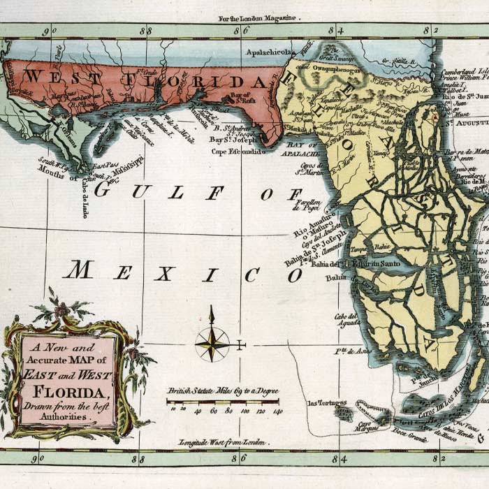
A New and Accurate Map of East and West Florida
Created in the 1760s, this map makes Florida look like shattered pottery in an effort to show its many swamps and rivers.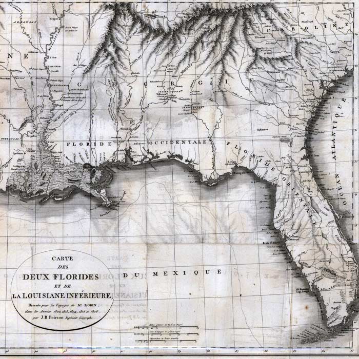
Carte des deux Florides et de la Louisiane Inférieure
This French map was published in 1807, several years after Napoleon sold Louisiana to the United States.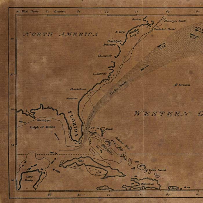
Chart of the Supposed Course of the Florida Stream
In 1804, cartographers greatly underestimated the range of the strong warm water current known Gulf Stream, here referred to as the Florida Stream.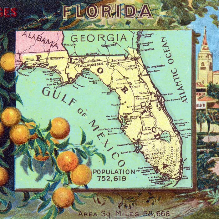
Florida
Dating back to about 1915, this postcard features a map that only shows the state’s railroads and boasts of a low population, which surpassed 20 million in 2015.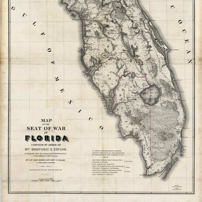
Map of the Seat of Warn in Florida
With the outbreak of the Second Seminole War in 1839, this map was created for General (and future U.S. President) Zachary Taylor. Like his predecessor Andrew Jackson, Taylor used military campaigns against Florida’s Indians as a springboard to the presidency.